
Hermine makes landfall in Tampa Bay
Source Bay News 9
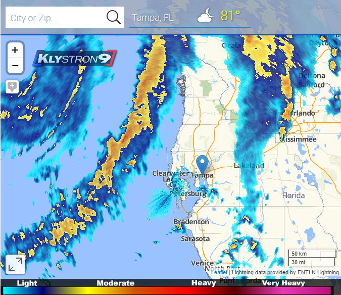
Several counties including Hillsborough have closed public schools for today and Friday due to the Tropical Depression nine making its way from the Gulf of Mexico. As of this afternoon TD9 has strengthened to a category one hurricane based on the increase of winds. The county buses would not be able to run with the predicted high winds. The inability to commute in such weather conditions was an apprehension. Several counties have been issued mandatory evacuation due to hurricane Hermine. Tampa Bay is expected to have a storm surge of two to four feet. More bands of bad weather will be coming in between 12 and two of Friday morning.
Hermine is moving north east which is really going to impact the north central tonight, as it continues to move up the coast. Winds as great as 80 mph close Skyway Bridge, Bayshore Boulevard and other major roads that have been effected by Hermine. and Although Tampa Bay will not most likely see the worst of Hurricane Hermine, we will continue to see a constant down poor, worsening late tonight and early morning.
The biggest concerns of Hermine in the bay area is the risk of falling trees. Saturated trees and high winds will cause many trees to fall, bringing down powerlines, homes, and cars. This could possibly leave quite an aftermath as we get through the weekend. More concern rises as flooding continues on Bayshore, and the areas along the gulf coast. Sand bags have been and are continuing to be administered at local community centers to prevent flooding.
It is recommended that everyone stays indoors as the storm closes in tonight. Though today’s lighter rain gave students the opportunity to enjoy the day off. In response to tonight’s weather, tomorrow students may not be so lucky. Local officials do not recommend driving- puddles are deeper than they appear.
Your donation will support the student journalists of HB Plant Senior High School - Newspaper. Your contribution will allow us to purchase equipment and cover our annual website hosting costs.