
A winter storm has impacted multiple parts of the United States this week, bringing with it sub-freezing temperatures, snowfall and icy conditions. The main affected areas include the Midwestern United States and the Northeast, with cities such as Chicago, New York and Boston at the epicentre of the disruptions. However, even states as south as Florida and Alabama have reported colder-than-usual temperatures. Authorities across the eastern United States have advised residents to exercise precaution as the cold front advances.
The cause of this cold weather can be linked to the behavior of the polar vertex. Typically confined to the Arctic, the polar vertex is a large, rotating mass of cold air that is usually centered around the North Pole. But due to a phenomenon known as sudden stratospheric warming, which is associated with the result of rapidly increasing temperatures in the stratosphere (often affecting the jet stream), the winds that kept the polar vertex in place weakened and split, allowing the frigid air positioned to the south of the vertex to spill even more southward toward Canada and the United States.
While the polar vertex and sudden stratospheric warming are natural phenomena, scientists are becoming increasingly concerned about the role of climate change in this event. The Arctic region has warmed at a quicker rate than other areas around the world, a trend known as “Arctic Amplification.” This tendency also contributes to the instability of the polar vertex, giving it another reason to spill cold air southward.
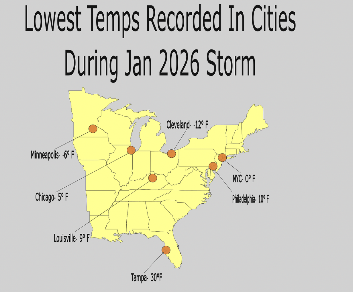
In the case of the recent winter storm, the Great Lakes Region (including the Canadian province Ontario and U.S. states Illinois, Michigan, Minnesota and Ohio) and the Northeast (including New England and Mid-Atlantic states) were in the direct path of this southward-moving air. Many sources such as Travel Pirates and WION even cited Ontario and Illinois the “coldest place on Earth.”
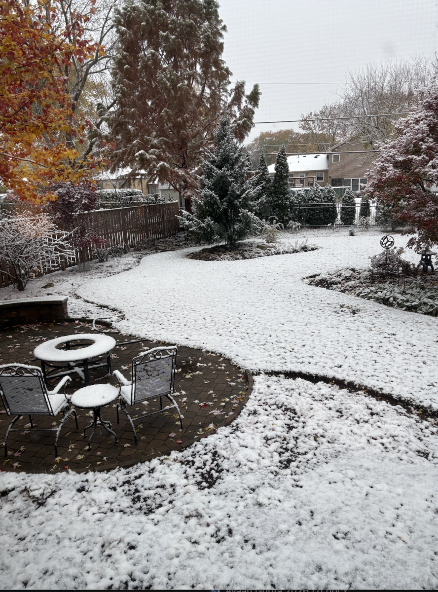
As mentioned earlier, the consequences of this storm have included low temperatures and icy conditions. In Chicago, the “lake effect” snowstorm took place, in which cold air moves over the adjacent Lake Michigan, creating narrow bands of heavy snow. As a result, the city and the surrounding suburbs have experienced north of 8 inches of snow according to NBC 5 Chicago. Additionally, the city’s weather plummeted to 10°F over the course of the past week.
In New York, 10 inches of snowfall were reported in Manhattan, while the Hudson Valley saw more than 18 inches. Heavy sleet and icy rain were also reported in the state, leaving more than one million residences without power.
In the entirety of the Northeast, over 17,000 flights were cancelled as major airports (John F. Kennedy, LaGuardia, Newark and Philadelphia) remained closed. Additionally, schools in New York, Boston and Philadelphia remained closed as the colder weather patterns persisted.
But even in cities as south as Tampa, the effects of the polar vertex have been observed. A freeze watch has been put in effect across Tampa Bay by the National Weather Service, bringing temperatures as low as 30°F, with windchills reaching as low as 25°F.
As the storm continues to move across the country, meteorologists are closely monitoring its progression, with more cold weather expected to affect areas in the Eastern United States over the coming days. While the immediate impact has already been severe, officials are advising residents to stay prepared for potential power outages and hazardous travel conditions. This event reflects the notion of the importance of vigilance in such events.